A short overview of the Anti-Atlas, Morocco
DR.Hervé Rezeau, DR.Cyril Chelle-Michou & DR.Michael Calder
SEG Student Chapter of Geneva (Switzerland)
SEG Student Chapter of Montpellier (France)
INTRODUCTION
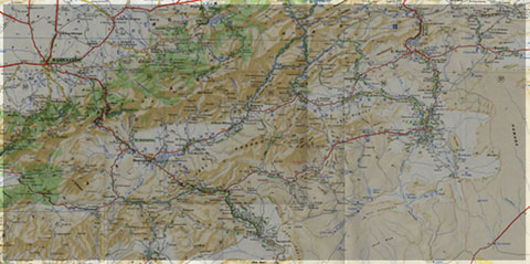
Geology of Morocco has been subdivided into four structural domains, from north to south they are the following: the Rif domain, the Meseta domain, the High Atlas, and the Anti-Atlas, as they are shown in (Figure 1).
The Rif Range extends along the Mediterranean coast from the Kabylian-Tellian belts up to the Strait of Gibraltar. South of it, the Meseta domain is located, where elevated plateaus and intramontane basins occur. Further south the High Atlas system is found, which displays several massifs close to 4000 m, including the highest peak of northern Africa (Jebel Toubkal). The Middle Atlas represents a branch of the Atlas system that extends obliquely across the Meseta domain, and exceeds 3000 m in elevation. Finally, the Anti-Atlas domain is found, which rises forming a massive mountain that achieves up to 2700 m. Further south the elevation decreases both southward and westward from ca. 1000 m to less than 200 m close to the Atlantic.

Figure 1: Elevation map of Morocco and neighbouring countries from GTOPO30 database (A. Michard et al. 2008)
GEOLOGICAL SETTING OF THE ANTI-ATLAS
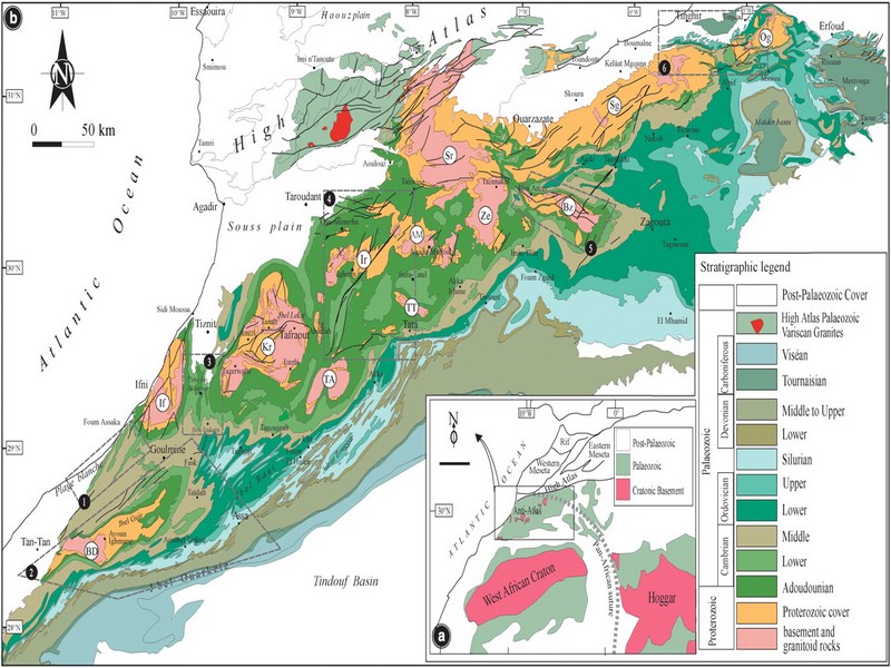
The Anti-Atlas mountain belt is located in the northern part of the West African Craton (WAC). It is stretching NE-SW and is characterized by Precambrian to late Proterozoic rocks covered by younger sediments of Edicaran to Cambrian in age. The geological boundary between the Anti-Atlas and High Atlas is structurally marked by the South Atlas fault (SAF) (Fig.2). The Anti-Atlas massif is a zone of wide domal uplift with much weaker Alpine age deformation. The volcanics and conglomerates rocks from the Ouarzazate & Bou Salda group in the North-East are surrounding the older volcanics rocks
The Anti-Atlas mountain belt is located in the northern part of the West African Craton (WAC). It is stretching NE-SW and is characterized by Precambrian to late Proterozoic rocks covered by younger sediments of Edicaran to Cambrian in age. The geological boundary between the Anti-Atlas and High Atlas is structurally marked by the South Atlas fault (SAF) (Fig.2). The Anti-Atlas massif is a zone of wide domal uplift with much weaker Alpine age deformation. The volcanics and conglomerates rocks from the Ouarzazate & Bou Salda group in the North-East are surrounding the older volcanics rocks and turbidite sequences from the Sahgro Group and the Pan-African granite intrusions. This geomorphological feature is commonly called inliers (“boutonnière” in French) and is the result of an exposed older rock formation surrounded by younger rock, and is due to a high erosion rate of rocks with different hardness but also encouraged by deformation such as folding and faulting (Gasquet et al. 2005). Several slivers of ophiolites are present in the Anti-Atlas belt, the best preserved are situated in the Bou Azzer, Siroua and Iriri region, which represent remnant of an ocean closure. The basement is composed of schists, granites and mylonites of Paleoproterozoic age. The latest Variscan and Alpine orogenic events overprint most of the Anti-Atlas geological province and thus complicate the Pre- Cambrian geodynamic interpretation. However, two main periods of tectono-thermal magmatic activity (Gasquet et al. 2005) are now recognised :
(i)A Palaeoproterozoic period, corresponding to the Eburnean (Birimian) orogeny,
(ii)A Neoproterozoic period, corresponding to the Pan-African orogeny.

Figure 2: Schematic map of the Anti-Atlas Precambrian inliers (Boutonnière), and location of the maps, satellite views and lithospheric profile presented hereafter (Gasquet et al. 2008)
Source web : DR.Hervé Rezeau, DR.Cyril Chelle-Michou & DR.Michael Calder unige.ch
Les articles en relation

Convergence promotionnelle entre le tourisme et l’artisanat
Convergence promotionnelle entre le tourisme et l’artisanat Le tourisme et l’artisanat sont appelés à développer davantage d’harmonie et de synergie. Un projet de création et de promot
Savoir plus...
Le changement climatique dans la région de Souss Massa (Géoparc Jbel Bani)
Le changement climatique dans la région de Souss Massa (Géoparc Jbel Bani) La région Souss-Massa est l'une des douze nouvelles régions du Maroc instituées&nbs
Savoir plus...
L'art préhistorique en 5 images exceptionnelles
Au cours du Paléolithique supérieur (période qui débute vers 30.000 av. J.-C.), les Hommes éprouvent le besoin de représenter leur quotidien et d'exprimer leurs émotions. Prése
Savoir plus...
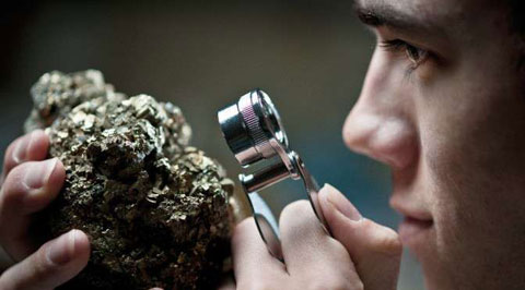
Minéraux
Minéraux Un DVD sur les minéraux, les cristalliers et les sites minéralogiques d'Oisans (Isère). Un minéral, de l'axinite des Alpes. A Bourg d'Oisans, les histoires de cristalliers
Savoir plus...
Ptérosaure géant : une toute nouvelle espèce découverte en France
Ptérosaure géant : une toute nouvelle espèce découverte en France En Provence, le gisement de Velaux la Bastide Neuve a livré des restes fossilisés d'un nouveau ptérosaure de grand
Savoir plus...
Tafraout : La Kasbah de Tazka inscrite sur la liste du Patrimoine culturel national (Géoparc Jbel Bani)
Tafraout : La Kasbah de Tazka inscrite sur la liste du Patrimoine culturel national (Géoparc Jbel Bani) La Kasbah de Tazka (Toughanj) à Tafraout, dans la province de Tiznit (Anti-Atlas), a été inscrite sur
Savoir plus...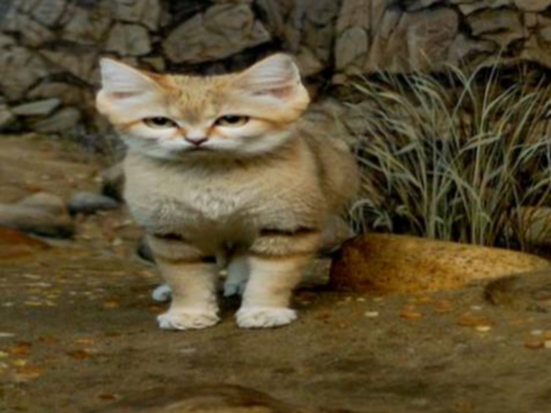
Le chat des sables
”Felis margarita”, le chat du désert Totalement adapté à la vie dans le désert du Sahara marocain, ce mammifère, dont l’existence est jugée en danger par l’UICN, reste
Savoir plus...
Retard des pluies: Faut-il craindre le pire?
Retard des pluies: Faut-il craindre le pire? Il est encore tôt pour prédire une année sèche Les mois de décembre et janvier seront de vrais baromètres Le régim
Savoir plus...
Le Géoparc Jbel Bani et Foum Zguid, à la porte du désert, la pastèque menace la nappe phréatique
Le Géoparc Jbel Bani et Foum Zguid, à la porte du désert, la pastèque menace la nappe phréatique A 170 km d’Ouarzazate, à Foum Zguid, c’est la porte du désert. Le tourisme
Savoir plus...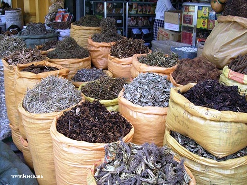
Les plantes aromatiques et médicinales (PAM) au Maroc
Les plantes aromatiques et médicinales (PAM) au Maroc La filière des plantes aromatiques et médicinales (PAM) au Maroc regorge de potentiel grâce à la diversité de ses espèces. Plus de
Savoir plus...
Liste de Géoparcs mondiaux UNESCO
Liste en anglais Last updated in 2016 pays nom des geoparcs adress Austria Styrian Eisenwurzen UNESCO Global Geopark arkt35,8933 St Gallen,Austria
Savoir plus...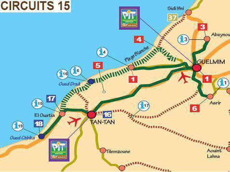
Circuits a la decouverte de la région Guelmim-géoparc jbel bani
Circuits a la decouverte de la région Guelmim-géoparc jbel bani Pour simple Berline : Excursions au départ de GUELMIM : Abaynou / Plage Blanche / Asrir-Tighmert / Tan Tan Avec 4x4 : Plage Blanc
Savoir plus...Les tags en relation
En savoir plus sur " Géologie et TSGJB - AMDGJB "
Consulter les vidéos de " Géologie et TSGJB - AMDGJB " Consulter les photos de " Géologie et TSGJB - AMDGJB " Consulter les publications de " Géologie et TSGJB - AMDGJB " Consulter les éditions de " Géologie et TSGJB - AMDGJB " Consulter les communications de " Géologie et TSGJB - AMDGJB "Recherche du site
Recherche avancée / Spécifique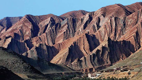
Géoparc et Recherche Scientifique
Le coins de l’étudiant

Blog Géoparc Jbel Bani
Dictionnaire scientifique
Plus de 123.000 mots scientifiques
Les publications
Géo parc Jbel Bani

Circuits & excursions touristiques
cartothéques
Photothéques
Publications & éditions