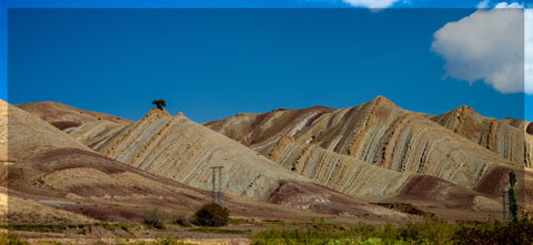
A short overview of the Anti-Atlas, Morocco
DR.Hervé Rezeau, DR.Cyril Chelle-Michou & DR.Michael Calder
SEG Student Chapter of Geneva (Switzerland)
SEG Student Chapter of Montpellier (France)
INTRODUCTION
Geology of Morocco has been subdivided into four structural domains, from north to south they are the following: the Rif domain, the Meseta domain, the High Atlas, and the Anti-Atlas, as they are shown in (Figure 1).
The Rif Range extends along the Mediterranean coast from the Kabylian-Tellian belts up to the Strait of Gibraltar. South of it, the Meseta domain is located, where elevated plateaus and intramontane basins occur. Further south the High Atlas system is found, which displays several massifs close to 4000 m, including the highest peak of northern Africa (Jebel Toubkal). The Middle Atlas represents a branch of the Atlas system that extends obliquely across the Meseta domain, and exceeds 3000 m in elevation. Finally, the Anti-Atlas domain is found, which rises forming a massive mountain that achieves up to 2700 m. Further south the elevation decreases both southward and westward from ca. 1000 m to less than 200 m close to the Atlantic.

Figure 1: Elevation map of Morocco and neighbouring countries from GTOPO30 database (A. Michard et al. 2008)
GEOLOGICAL SETTING OF THE ANTI-ATLAS
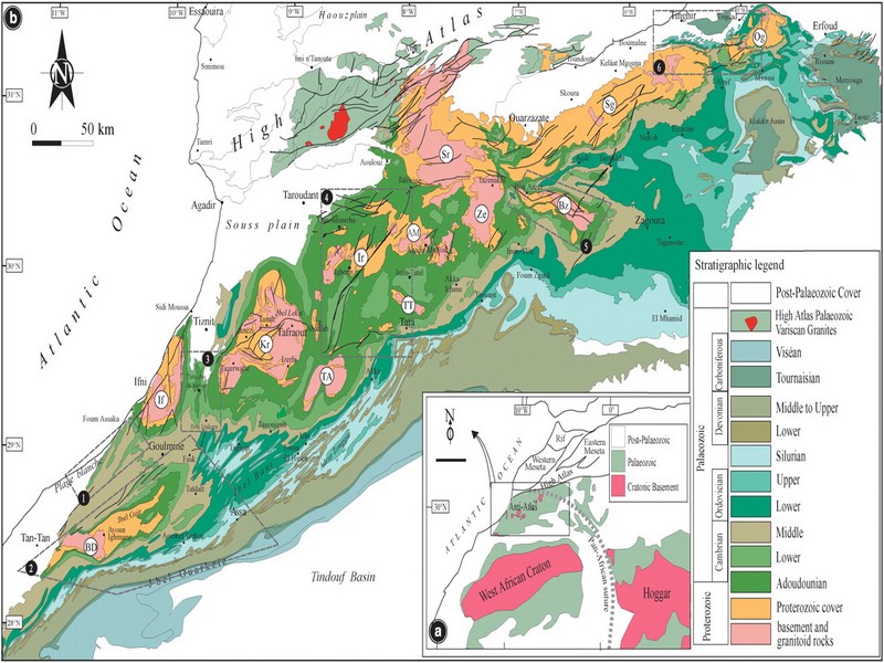
The Anti-Atlas mountain belt is located in the northern part of the West African Craton (WAC). It is stretching NE-SW and is characterized by Precambrian to late Proterozoic rocks covered by younger sediments of Edicaran to Cambrian in age. The geological boundary between the Anti-Atlas and High Atlas is structurally marked by the South Atlas fault (SAF) (Fig.2). The Anti-Atlas massif is a zone of wide domal uplift with much weaker Alpine age deformation. The volcanics and conglomerates rocks from the Ouarzazate & Bou Salda group in the North-East are surrounding the older volcanics rocks
The Anti-Atlas mountain belt is located in the northern part of the West African Craton (WAC). It is stretching NE-SW and is characterized by Precambrian to late Proterozoic rocks covered by younger sediments of Edicaran to Cambrian in age. The geological boundary between the Anti-Atlas and High Atlas is structurally marked by the South Atlas fault (SAF) (Fig.2). The Anti-Atlas massif is a zone of wide domal uplift with much weaker Alpine age deformation. The volcanics and conglomerates rocks from the Ouarzazate & Bou Salda group in the North-East are surrounding the older volcanics rocks and turbidite sequences from the Sahgro Group and the Pan-African granite intrusions. This geomorphological feature is commonly called inliers (“boutonnière” in French) and is the result of an exposed older rock formation surrounded by younger rock, and is due to a high erosion rate of rocks with different hardness but also encouraged by deformation such as folding and faulting (Gasquet et al. 2005). Several slivers of ophiolites are present in the Anti-Atlas belt, the best preserved are situated in the Bou Azzer, Siroua and Iriri region, which represent remnant of an ocean closure. The basement is composed of schists, granites and mylonites of Paleoproterozoic age. The latest Variscan and Alpine orogenic events overprint most of the Anti-Atlas geological province and thus complicate the Pre- Cambrian geodynamic interpretation. However, two main periods of tectono-thermal magmatic activity (Gasquet et al. 2005) are now recognised :
(i)A Palaeoproterozoic period, corresponding to the Eburnean (Birimian) orogeny,
(ii)A Neoproterozoic period, corresponding to the Pan-African orogeny.

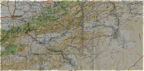
Figure 2: Schematic map of the Anti-Atlas Precambrian inliers (Boutonnière), and location of the maps, satellite views and lithospheric profile presented hereafter (Gasquet et al. 2008)
Source web : DR.Hervé Rezeau, DR.Cyril Chelle-Michou & DR.Michael Calder unige.ch
Les articles en relation
Oued Akka
L’Adrar Metgourine A 11 km au Nord d’Akka, la gara de Metgourine se présente comme un îlot dominant la plaine à un coude de l'oued Akka. Du côté Ouest, elle offre un escalier de da
Savoir plus...
Empreintes de dinosaures : la plus longue piste de sauropode est en France!
Empreintes de dinosaures : la plus longue piste de sauropode est en France! En 2009, la découverte d'empreintes d'un dinosaure gigantesque, à Plagne, dans le massif du Jura, avait été annoncé
Savoir plus...
Fiche technique du SIBE "Jbel Kest (62)" (Géoparc Jbel Bani)
Fiche technique du SIBE "Jbel Kest (62)" (Géoparc Jbel Bani) Date de publication 27/11/2006 Couverture géographique Maroc, Mots-clefs Aire protégée, SIBE, Coordonnées : 29°
Savoir plus...
Errachidia: Introduction de 100 gazelles dorcas
Errachidia: Introduction de 100 gazelles dorcas (Source : ecologie.ma) Ce 10 Janvier, Le Haut Commissariat aux Eaux et Forêts et à la Lutte Contre la Désertification (HCEDLCD) a r&
Savoir plus...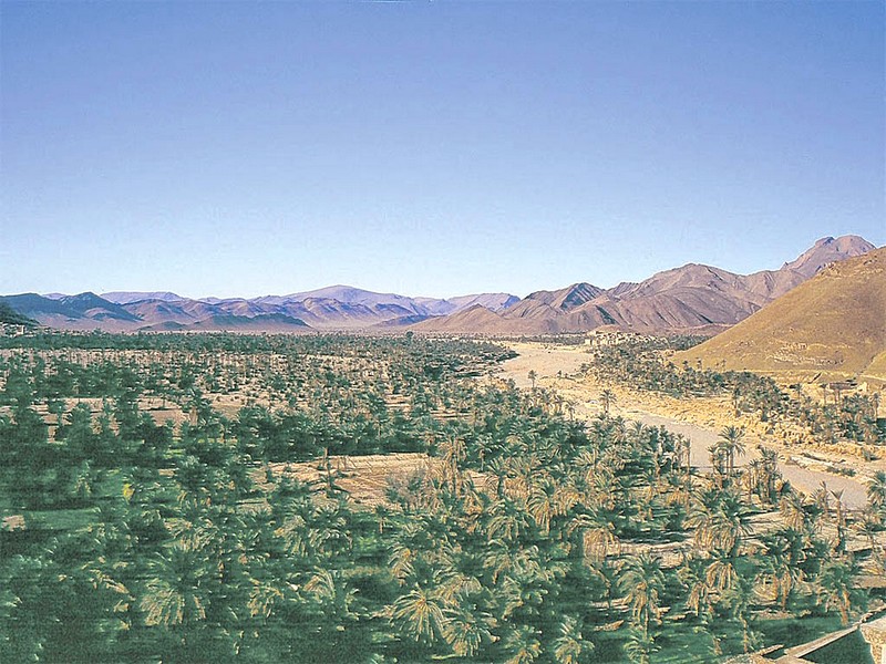
Naissance d’une association pour le développement du Géoparc de Jbel Bani à Tata (Géoparc Jbel Bani)
Naissance d’une association pour le développement du Géoparc de Jbel Bani à Tata (Géoparc Jbel Bani) La ville de Tata a abrité, le 10 avril courant, la 8ème édition de sa foire a
Savoir plus...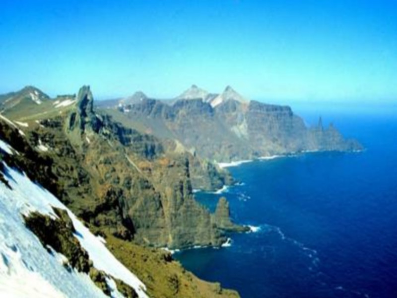
Le géologue, entre nomadisme et sédentarité » par Hervé LEYRIT
Le géologue est-il un aventurier, un nomade, un vagabond? Ou bien est-il un jeune cadre dynamique qui intègre la mondialisation dans sa carrière? Dans sa vie professionnelle, l'expatriation sera-t-elle choisie o
Savoir plus...
Des continents perdus découverts sous la glace en Antarctique
Des continents perdus découverts sous la glace en Antarctique Les mesures fines du champ de gravité de la Terre par le satellite de l'ESA Goce ont permis de voir sous la glace de l'Antarctique. Les géophy
Savoir plus...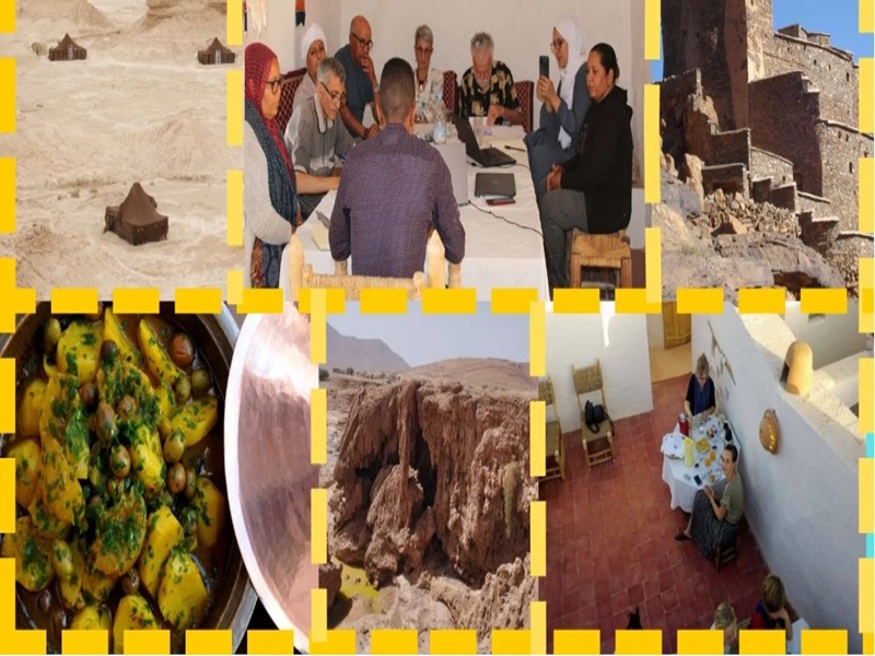
Le Territoire Soutenable du Géoparc Jbel Bani (TSGJB) : Un modèle de tourisme durable au Maroc
Le Territoire Soutenable du Géoparc Jbel Bani (TSGJB) : Un modèle de tourisme durable au Maroc Le Geoparc Jbel Bani, situe au sud du Maroc, représente une initiative remarquable en matière de tou
Savoir plus...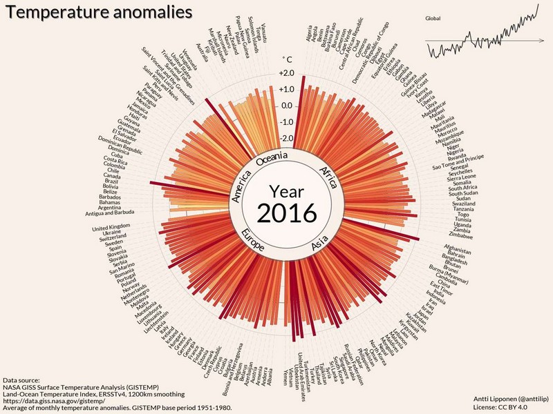
L'histoire du réchauffement climatique en 35 secondes
L'histoire du réchauffement climatique en 35 secondes En intégrant graphiquement les mesures de températures dans presque tous les pays du Globe entre 1900 et 2016, cette animation montre de façon sais
Savoir plus...
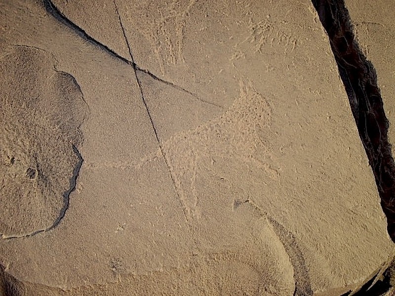
Des chiens en laisse à la Préhistoire !
Des chiens en laisse à la Préhistoire ! Dans les scènes de chasse de deux sites d'art rupestre d'Arabie saoudite datant du prénéolithique, des dizaines de chiens sont gravés en compag
Savoir plus...
Photos: Trois jeunes canis dans l’Anti Atlas
Photos: Trois jeunes canis dans l’Anti Atlas Ali Irizi a encore frappé. Cette fois il s’agit de trois louveteaux quelque part dans l’anti Atlas. Cette fois encore la photo ne manque pas de susciter questions et &
Savoir plus...
Patrimoine : Des artisans marocains en Afrique du Sud
Patrimoine : Des artisans marocains en Afrique du Sud Dans la ville sud-africaine de Durban, un projet de transformation d’une église en mosquée a nécessité de faire appel à l’expertise
Savoir plus...Les tags en relation
En savoir plus sur " Géologie et TSGJB - AMDGJB "
Consulter les vidéos de " Géologie et TSGJB - AMDGJB " Consulter les photos de " Géologie et TSGJB - AMDGJB " Consulter les publications de " Géologie et TSGJB - AMDGJB " Consulter les éditions de " Géologie et TSGJB - AMDGJB " Consulter les communications de " Géologie et TSGJB - AMDGJB "Recherche du site
Recherche avancée / Spécifique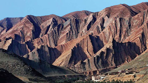
Géoparc et Recherche Scientifique
Le coins de l’étudiant

Blog Géoparc Jbel Bani
Dictionnaire scientifique
Plus de 123.000 mots scientifiques
Les publications
Géo parc Jbel Bani

Circuits & excursions touristiques
cartothéques
Photothéques
Publications & éditions