
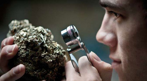
ORE DEPOSITS IN THE ANTI-ATLAS AND SUB-ATLAS REGIONS
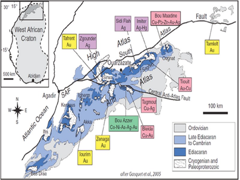
The Anti-Atlas geological province is the host of a variety of ore deposits, ranging from Paléoprotérozoïque to Ordovician in age. These deposits are mainly Cu-Au porphyry types, precious metal epithermal (Au, Ag) or polymetallic VMS base metals (Cu, Pb, Zn, Au, and Ag), while the sub- Atlas region presents an important occurrence of manganese. Figure 8 shows the location of the most important deposits in the Anti-Atlas region.
Located in eastern Anti-Atlas, the world class Imiter Ag-Hg mine (8.5 Mt at 700g/t Ag), is among the most important deposits in Morocco. It is considered to be of epithermal origin. The silver mineralisation happened during regional extension (+/- transpession?) tectonic regime event around 550 and is hosted in a series of volcanic felsic rocks Ma (Tuduri et al, 2006). Briefly, a three-stage model has been proposed to explain the deposit: a first episode characterized by the development of quartz, pink dolomite, and Ag-rich minerals veins formed during a dextral transpressive event, followed by a barren stage associated with a normal left-lateral motion that re-opened previous structures, and a final alteration stage (i.e. supergene enrichment) that contributed to local enrichment in Ag deposit (Tuduri et al, 2006).
Regarding copper, Bleida was the most important Cu deposit of northern Africa until late 90’s. Located on the northern edge of the West African Craton, the Bleida orebodies are located on an inactive continental margin along with preserved ophiolites of Upper Proterozoic age. The copper deposits (chalcopyrite, bornite, pyrite) are stratiform distal massive sulfide bodies whose position is controlled by both the sedimentation of shales and an acid volcanism, which follows a more important basic volcanism. Pan-African deformation (650-600 Ma) has determined the current geometry of the cupriferous lenses although it has not remobilized the sulfides out of their original carrier beds (Leblanc and Billaud, 2006). West of the main Moroccan Bleida copper deposit, gold mineralization has also been discovered (West Bleida, ca. 3 tonnes metal Au). It is hosted by metamorphosed and deformed mafic to intermediate volcanic rocks that are part of the Neoproterozoic tholeiitic volcano-sedimentary series forming the stratigraphically upper part of the Bou Azzer ophiolite sequence. Gold mineralization primarily occurs
as deformed gold-bearing quartz veins and disseminations in Cu-rich chert zones (chalcopyrite– malachite), Fe-rich lithofacies and breccia zones. Gold is accompanied by small amounts of copper sulphides (<1% modal chalcopyrite).
Another important occurrence (not displayed in the map, Fig. 8) is the Imini Manganese deposit, the most important Mn deposit of Morocco, located in the western margin of the Ouarzazate foreland basin (Sub-Atlas). The manganese ore is made of pyrolusite (MnO2), and is hosted in different horizons of dolomites from the lower Cretaceous, and another accessory layer. This layers thickness can reach up to 1 meter. The deposit scale is 25 km per 100-400 m width, and sits above slates and crystalline rocks. Dolomitic sandstone and/or conglomerate are present between each mineralized horizon. Isabel von Steinaecker; source: http://www.geo.tu-freiberg.de/oberseminar/os03_04/Isabel_Steinaecker.pdf).

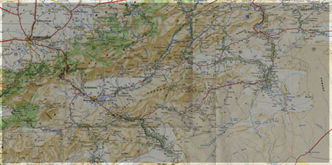
Figure 8: The Anti-Atlas belt at the northern limit of the West African Craton. Redrawn after Dallmeyer and Lecorché (1991) and a geological sketch map of the Anti-Atlas belt in southern Morocco and location of main ore deposits. SAF: South Atlas Fault. Gasquet and al. (2005)
Source web par unige.ch
Les articles en relation

La Nasa envisage de coloniser Vénus avec des dirigeables
La Nasa envisage de coloniser Vénus avec des dirigeables L'idée semble folle mais elle ne l'est pas. Vénus serait plus facilement colonisable que Mars sous forme de mini-biosphères flottant à
Savoir plus...
QUALITES BIOECOLOGIQUES (Jbel lkest)
QUALITES BIOECOLOGIQUES (Jbel lkest) QUALITES BIOECOLOGIQUES Flore et Végétation : - Argania spinosa - Tetraclinis articulata - Quercus rotundifolia Végétation et flore diversifiées a
Savoir plus...
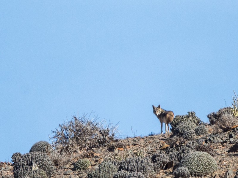
Le Loup de Guelmim (Observation filmée)
Le Loup de Guelmim (Observation filmée) Le Loup de Guelmim. C’est la première observation qui nous est rapporté en ce début 2016. « Quelques parts » dans la région de Guelmim, A
Savoir plus...
Le Drâa, à travers les gravures rupestres
Le Drâa ( Sud marocain ), à travers les gravures rupestres Les gravures rupestres sont une matière première très riche et qui permet d’écrire l’histoire. Ces documents rupestres qu
Savoir plus...
Gravures rupestres de la préhistoire d'Aït Ouaazik au Maroc
Gravures rupestres de la préhistoire d'Aït Ouaazik au Maroc Les Gravures rupestres de la préhistoire d'Aït Ouaazik au Maroc sont des gravures préhistoriques d'âge néolithique ap
Savoir plus...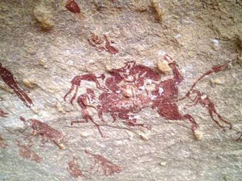
Appel à la protection des gravures rupestres de Nâama
Appel à la protection des gravures rupestres de Nâama Découverte en 1847 par une expédition française, la station de Tiout, dans le Sud de la wilaya de Naâma, date de plus de 8 000 ans avant J.
Savoir plus...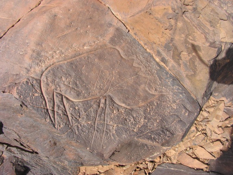
Maroc : Appel pour la préservation des sites rupestres dans la région de Tata
Maroc : Appel pour la préservation des sites rupestres dans la région de Tata Les travaux d’une rencontre tenue, récemment à Tata, sur la préservation des sites rupestres de la province ont &e
Savoir plus...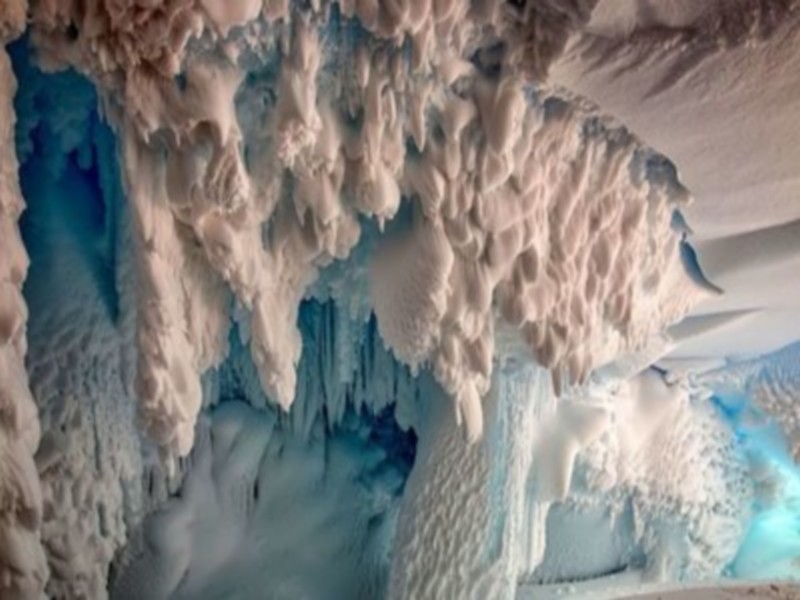
Une forêt vieille de 280 millions d'années découverte... en Antarctique
Une forêt vieille de 280 millions d'années découverte... en Antarctique L’Antarctique n’a pas toujours été cette étendue blanche et glacée qui la caractérise auj
Savoir plus...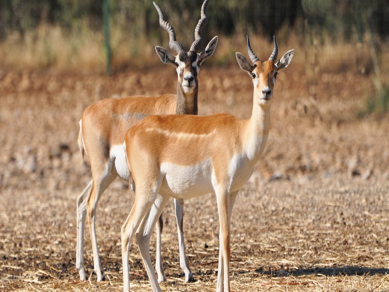
Les 5 antilopes du Maroc
Les Antilopes constituent un groupe de Mammifères Ruminants, rangés parmi les Bovidés. Les antilopes descendent de l’Eotragus, apparu au Miocène, il y a 15 à 17 millions d’an
Savoir plus...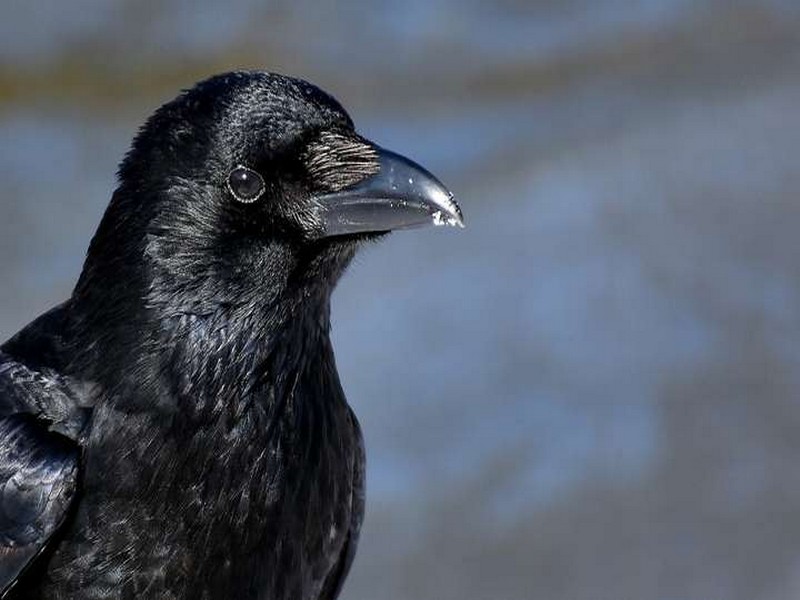
Des corbeaux ont appris à fabriquer des outils complexes tout seuls
Des corbeaux ont appris à fabriquer des outils complexes tout seuls Les chercheurs pensaient que cette aptitude était l'apanage des Hommes... et des grands singes. Mais une équipe internationale rév&eg
Savoir plus...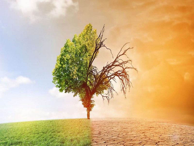
Les conséquences du réchauffement climatique
Les conséquences du réchauffement climatique Les experts prévoient que le changement climatique en cours résultant des activités humaines aura quelques conséquences que l'on peut qualifie
Savoir plus...Les tags en relation
En savoir plus sur " Géologie et TSGJB - AMDGJB ! "
Consulter les vidéos de " Géologie et TSGJB - AMDGJB ! " Consulter les photos de " Géologie et TSGJB - AMDGJB ! " Consulter les publications de " Géologie et TSGJB - AMDGJB ! " Consulter les éditions de " Géologie et TSGJB - AMDGJB ! " Consulter les communications de " Géologie et TSGJB - AMDGJB ! "Recherche du site
Recherche avancée / SpécifiqueVulgarisation à la géologie
Qu'est ce que les sciences de la terre: vulgarisation Qu'est ce que la géologie ? Géologie et TSGJB - AMDGJB !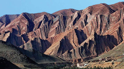
Géoparc et Recherche Scientifique
Le coins de l’étudiant
Blog Géoparc Jbel Bani
Dictionnaire scientifique
Plus de 123.000 mots scientifiques
Les publications
Géo parc Jbel Bani

Circuits & excursions touristiques
cartothéques
Photothéques
Publications & éditions