
CENTRAL ANTI-ATLAS TRAVERSE: the northern border of the West African Craton
By DR. M. OUKASSOU, DR. H. EL HADI, DR. F. HAISSEN, DR. N. SABER
ITINERARY and OBJECTIVES
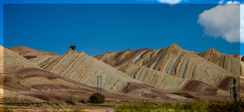
The south of Morocco is one of the most attractive touristic areas with diversified landscapes from snowy mountains to desert plains. The High Atlas with his 3000 to 4000 meters forms a major climatic barrier to the Atlantic perturbations, which account for the arid climate of the Anti Atlas sub Saharan domain south of the chain. These regions are occupied by berbere speaking populations with long hospitality tradition.
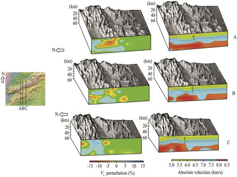
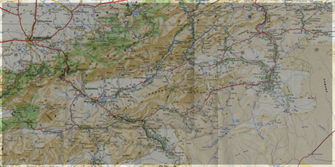
The two day trips follow most touristic roads and visit outstanding outcrops illustrating a central transect across the Anti-Atlas belt (figures G1 & G2), which corresponds to the external fold belt of the Hercynian (Variscan, Alleghanian) chain, but it also includes large Pan African inliers. The High Atlas formed during the Cenozoic at the expense of an aborted Triassic Jurassic rift. Therefore, three superimposed Wilsonian cycles can be illustrated during the trips. The itinerary will make possible to illustrate the complex geological history of these areas from 2 Ga to present day. Our purpose is to present and discuss various regional and thematic (sediment logical, structural, magmatic and
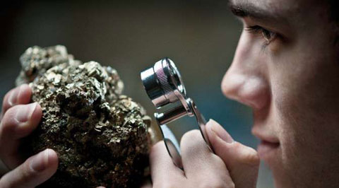
metamorphic) features, which record the main geodynamical events during this long geological history. Magnificent minerals (erhytrite, vanadinite...) and fossils (trilobites, goniatites...) can be purchased at many places.
During this field trip, the AgdzBou Azzer Tazenakht Agdzloop (figureG3)allows the participants to discover the PanAfrican belt (external platform domain in the Zenaga inlier, ophiolitic suture zone at Bou Azzer), the early volcano clastic cover sequence (late Neoproterozoic), and the mildly folded Early Paleozoic sediments (Cambrian and Ordovician).
Detailed road log for the trip are provided below along with Global Positioning Satellite (GPS) location at each stop. Note that all the stops are on public roads, and that the use of hammers and the collection of rocks are permitted.


Source web: DR. M. OUKASSOU, DR. H. EL HADI, DR. F. HAISSEN, DR. N. SABER sociedadgeologica.es
Les articles en relation

Météorite de Tissint
La météorite de Tissint est une météorite martienne de type shergottite tombée à Tissint au Maroc dans la province de Tata le 18 juillet 2011. Elle a été retrouvée par des n
Savoir plus...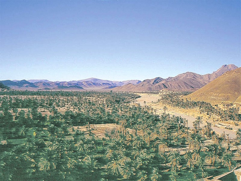
Naissance d’une association pour le développement du Géoparc de Jbel Bani à Tata (Géoparc Jbel Bani)
Naissance d’une association pour le développement du Géoparc de Jbel Bani à Tata (Géoparc Jbel Bani) La ville de Tata a abrité, le 10 avril courant, la 8ème édition de sa foire a
Savoir plus...
Atlas, le robot de Boston Dynamics, toujours plus étonnant et agile
Dans une nouvelle vidéo tournée par Boston Dynamics, on découvre le robot humanoïde Atlas en train d'effectuer un « parkour » démontrant ses progrès. Nous l'avions quitt&eac
Savoir plus...
Liste de Géoparcs mondiaux UNESCO
Liste en anglais Last updated in 2016 pays nom des geoparcs adress Austria Styrian Eisenwurzen UNESCO Global Geopark arkt35,8933 St Gallen,Austria
Savoir plus...
Au nord du jbel Bani (Préhistoire et Jbel Bani)
Site de Lghola En bas de la grande descente du Tizi Guettara par l’oued Feija, après un ressaut, arrivée dans une zone de tumulus. L’ensemble domine la grande plaine qui relie Zagora à Foum Zguid. Sur
Savoir plus...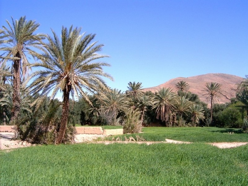
Ouarzazate colloque Espace oasien : Pour la préservation du patrimoine matériel et immatériel
Ouarzazate colloque Espace oasien : Pour la préservation du patrimoine matériel et immatériel Un énième colloque autour de l’espace oasien. Va-t-on aboutir à une politique d’inter
Savoir plus...
Jbel Saghro, paysage lunaire et fief de la tribu nomade légendaire des Ait Atta
Jbel Saghro offre des paysages à couper le souffle. Un endroit idéal pour faire des randonnées et des trekkings sur plusieurs jours. La région aux roches volcaniques de Saghro est notre volet touristique de l
Savoir plus...
Patrimoine : Le Maroc en état d’alerte
Patrimoine : Le Maroc en état d’alerte Le royaume compte se doter d’un plan pour lutter contre le trafic illicite des biens culturels. Un programme dans ce sens vient d’être lancé en partenariat
Savoir plus...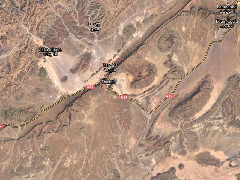
La Tribu Ait Tissint
La Tribu Ait Tissint Histoire d' Ait Tissint Tissint en berbère signifie "le sel", cela vient de l'eau de son oued légèrement salée. La tribu Ait Tissint est composée d'&
Savoir plus...
Climat méditerranéen
Climat méditerranéen Un climat se définit grâce à différentes données météorologiques. Les températures et les précipitations sont déterminantes en la
Savoir plus...Les tags en relation
En savoir plus sur " Géologie et TSGJB - AMDGJB ! "
Consulter les vidéos de " Géologie et TSGJB - AMDGJB ! " Consulter les photos de " Géologie et TSGJB - AMDGJB ! " Consulter les publications de " Géologie et TSGJB - AMDGJB ! " Consulter les éditions de " Géologie et TSGJB - AMDGJB ! " Consulter les communications de " Géologie et TSGJB - AMDGJB ! "Recherche du site
Recherche avancée / SpécifiqueVulgarisation à la géologie
Qu'est ce que les sciences de la terre: vulgarisation Qu'est ce que la géologie ? Géologie et TSGJB - AMDGJB !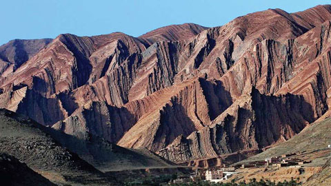
Géoparc et Recherche Scientifique
Le coins de l’étudiant

Blog Géoparc Jbel Bani
Dictionnaire scientifique
Plus de 123.000 mots scientifiques
Les publications
Géo parc Jbel Bani

Circuits & excursions touristiques
cartothéques
Photothéques
Publications & éditions