A short overview of the Anti-Atlas, Morocco
DR.Hervé Rezeau, DR.Cyril Chelle-Michou & DR.Michael Calder
SEG Student Chapter of Geneva (Switzerland)
SEG Student Chapter of Montpellier (France)
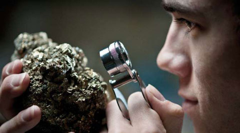
INTRODUCTION
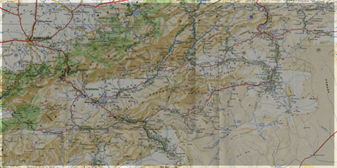
Geology of Morocco has been subdivided into four structural domains, from north to south they are the following: the Rif domain, the Meseta domain, the High Atlas, and the Anti-Atlas, as they are shown in (Figure 1).
The Rif Range extends along the Mediterranean coast from the Kabylian-Tellian belts up to the Strait of Gibraltar. South of it, the Meseta domain is located, where elevated plateaus and intramontane basins occur. Further south the High Atlas system is found, which displays several massifs close to 4000 m, including the highest peak of northern Africa (Jebel Toubkal). The Middle Atlas represents a branch of the Atlas system that extends obliquely across the Meseta domain, and exceeds 3000 m in elevation. Finally, the Anti-Atlas domain is found, which rises forming a massive mountain that achieves up to 2700 m. Further south the elevation decreases both southward and westward from ca. 1000 m to less than 200 m close to the Atlantic.

Figure 1: Elevation map of Morocco and neighbouring countries from GTOPO30 database (A. Michard et al. 2008)
GEOLOGICAL SETTING OF THE ANTI-ATLAS
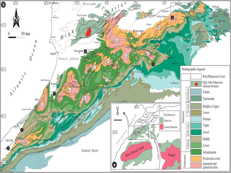
The Anti-Atlas mountain belt is located in the northern part of the West African Craton (WAC). It is stretching NE-SW and is characterized by Precambrian to late Proterozoic rocks covered by younger sediments of Edicaran to Cambrian in age. The geological boundary between the Anti-Atlas and High Atlas is structurally marked by the South Atlas fault (SAF) (Fig.2). The Anti-Atlas massif is a zone of wide domal uplift with much weaker Alpine age deformation. The volcanics and conglomerates rocks from the Ouarzazate & Bou Salda group in the North-East are surrounding the older volcanics rocks
The Anti-Atlas mountain belt is located in the northern part of the West African Craton (WAC). It is stretching NE-SW and is characterized by Precambrian to late Proterozoic rocks covered by younger sediments of Edicaran to Cambrian in age. The geological boundary between the Anti-Atlas and High Atlas is structurally marked by the South Atlas fault (SAF) (Fig.2). The Anti-Atlas massif is a zone of wide domal uplift with much weaker Alpine age deformation. The volcanics and conglomerates rocks from the Ouarzazate & Bou Salda group in the North-East are surrounding the older volcanics rocks and turbidite sequences from the Sahgro Group and the Pan-African granite intrusions. This geomorphological feature is commonly called inliers (“boutonnière” in French) and is the result of an exposed older rock formation surrounded by younger rock, and is due to a high erosion rate of rocks with different hardness but also encouraged by deformation such as folding and faulting (Gasquet et al. 2005). Several slivers of ophiolites are present in the Anti-Atlas belt, the best preserved are situated in the Bou Azzer, Siroua and Iriri region, which represent remnant of an ocean closure. The basement is composed of schists, granites and mylonites of Paleoproterozoic age. The latest Variscan and Alpine orogenic events overprint most of the Anti-Atlas geological province and thus complicate the Pre- Cambrian geodynamic interpretation. However, two main periods of tectono-thermal magmatic activity (Gasquet et al. 2005) are now recognised :
(i)A Palaeoproterozoic period, corresponding to the Eburnean (Birimian) orogeny,
(ii)A Neoproterozoic period, corresponding to the Pan-African orogeny.

Figure 2: Schematic map of the Anti-Atlas Precambrian inliers (Boutonnière), and location of the maps, satellite views and lithospheric profile presented hereafter (Gasquet et al. 2008)
Source web : DR.Hervé Rezeau, DR.Cyril Chelle-Michou & DR.Michael Calder unige.ch
Les articles en relation

La mangouste Ichneumon (نمس)
La mangouste Ichneumon (نمس) Le rat des pharaons (Herpestes ichneumon en latin, نمس en Darija ), mangouste d’Égypte ou mangouste ichneumon est une espèce de petit mammifère carnivore, qui depuis touj
Savoir plus...
Le curcuma fait ce que la chimio ne peut pas faire: il bloque naturellement la croissance du cancer
Le curcuma fait ce que la chimio ne peut pas faire: il bloque naturellement la croissance du cancer Le curcuma est une ancienne médecine ayurvédique qui a été utilisée pendant des siècles dan
Savoir plus...
Climat subarctique
Climat subarctique Un climat se définit grâce à différentes données météorologiques. Les températures et les précipitations sont déterminantes en la matière.
Savoir plus...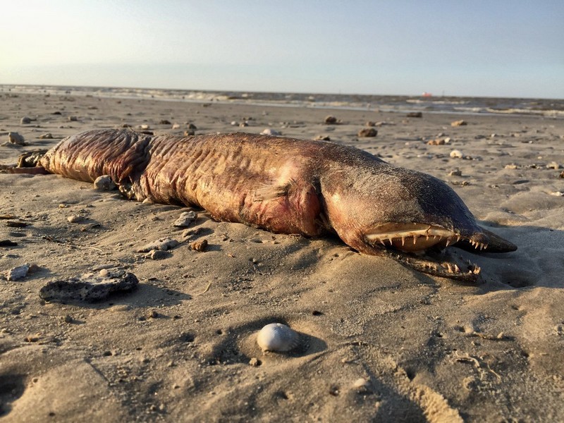
Un monstre marin sans yeux et aux dents en lame de rasoir rejeté par Harvey (photos)
Un monstre marin sans yeux et aux dents en lame de rasoir rejeté par Harvey (photos) Attention! Même des biologistes ont du mal à déterminer ce que c’est. Découvrez cette effrayante cr
Savoir plus...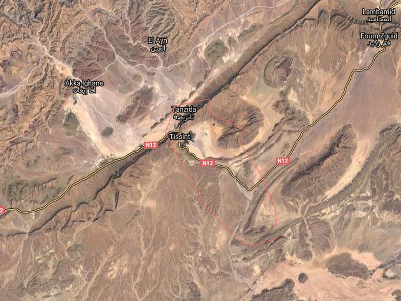
La Tribu Ait Tissint
La Tribu Ait Tissint Histoire d' Ait Tissint Tissint en berbère signifie "le sel", cela vient de l'eau de son oued légèrement salée. La tribu Ait Tissint est composée d'&
Savoir plus...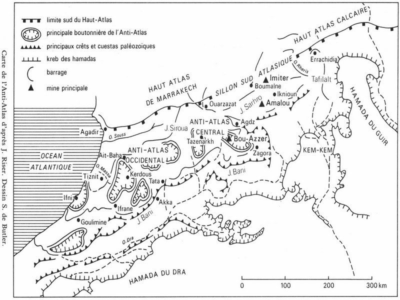
Les données structurales : un vieux socle aux formes puissantes (Anti-Atlas) pour J. Riser
Les données structurales : un vieux socle aux formes puissantes (Anti-Atlas) pour J. Riser La chaîne de l’Anti-Atlas est un immense voussoir dont l’ossature, dans sa partie occidentale et centrale, est consti
Savoir plus...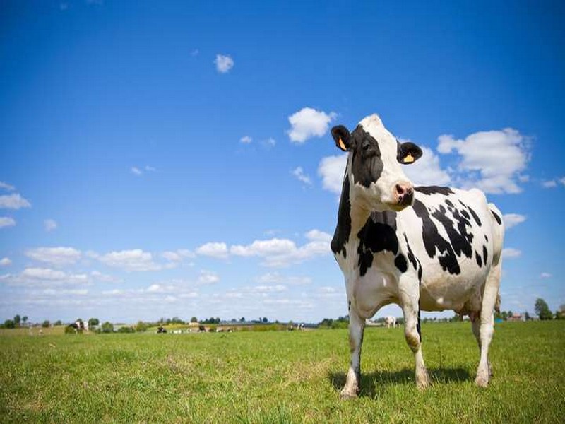
Vache
Vache La vache est un bovin de l'espèce Bos taurus. De manière générale, les bovins ont un mufle sans poil, humide autour des narines, des cornes lisses, creuses et persistantes, des molaires à
Savoir plus...
Liste de Géoparc mondiaux UNESCO trans-nationaux
Liste en anglais Last updated in 2016 pays nom des geoparcs adress Austria & Slovenia Karawanken / Karavanke UNESCO Global Geopark Hauptplat
Savoir plus...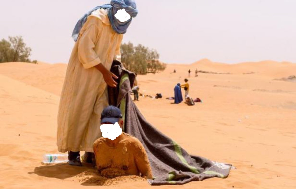
Sablo-thérapie :Zagora - l'été des bains de sable au Sud marocain
Sablo-thérapie :Zagora - l'été des bains de sable au Sud marocain Le bain de sable votre médecin naturel Zagora vous présente des étendues de sable brulant aperte de vue, c'est la ou
Savoir plus...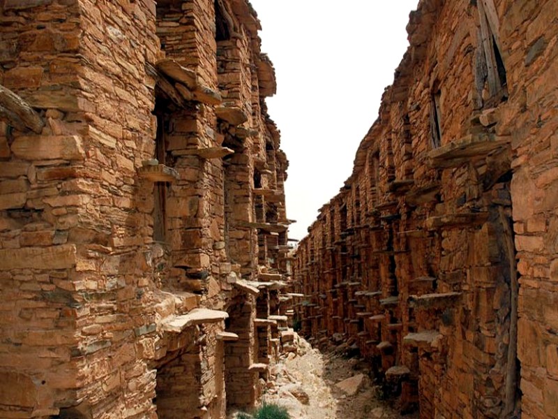
Restauration des Igoudars : le grenier d'Immchguiguen renaît dans l'Anti-Atlas
Restauration des Igoudars : le grenier d'Immchguiguen renaît dans l'Anti-Atlas La région de Souss-Massa poursuit ses efforts pour préserver et valoriser son patrimoine culturel unique. Dans l’arri&eg
Savoir plus...
VOICI UNE LISTE DE PLANTES MÉDICINALES La sauge est neurotoxique, à fortement déconseiller aux enfants, femmes enceintes ou allaitantes, et épileptiques.
Liste de plantes, épices et condiments ayant des vertus médicinales, et recettes de quelques préparations basiques. Connues de nos ancêtres lorsque la médecine moderne n’existait pas, ces plantes,
Savoir plus...Les tags en relation
En savoir plus sur " Géologie et TSGJB - AMDGJB "
Consulter les vidéos de " Géologie et TSGJB - AMDGJB " Consulter les photos de " Géologie et TSGJB - AMDGJB " Consulter les publications de " Géologie et TSGJB - AMDGJB " Consulter les éditions de " Géologie et TSGJB - AMDGJB " Consulter les communications de " Géologie et TSGJB - AMDGJB "Recherche du site
Recherche avancée / Spécifique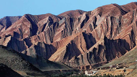
Géoparc et Recherche Scientifique
Le coins de l’étudiant
Blog Géoparc Jbel Bani
Dictionnaire scientifique
Plus de 123.000 mots scientifiques
Les publications
Géo parc Jbel Bani

Circuits & excursions touristiques
cartothéques
Photothéques
Publications & éditions